
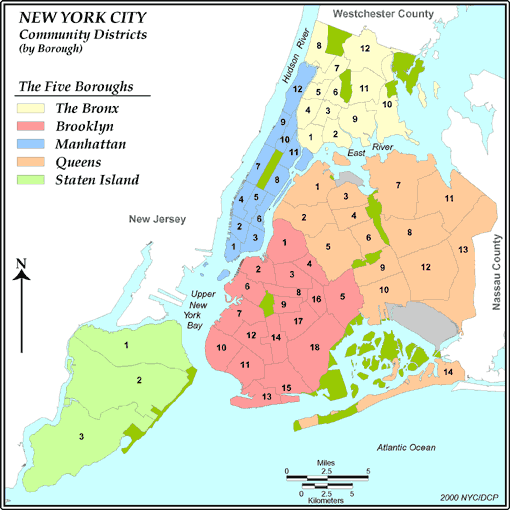
New York Community Districts
Ranked by Population Density Change from 1970
|
|
|
|
Population |
|
|
Land Area |
Population per Square Mile |
|
|
|
Rank |
District # and Name |
1970 |
1980 |
1990 |
2000 |
Square Miles |
1970 |
1980 |
1990 |
2000 |
Change from 1970 |
|
|
|
|
|
|
|
|
|
|
|
|
|
|
|
1 |
M1 |
Battery Park City, Tribeca |
7,706 |
15,918 |
25,366 |
34,420 |
1.72 |
4,480 |
9,255 |
14,748 |
20,012 |
346.7% |
|
2 |
S3 |
Tottenville, Woodrow, Great Kills |
72,815 |
108,249 |
126,956 |
152,908 |
22.77 |
3,198 |
4,754 |
5,576 |
6,715 |
110.0% |
|
3 |
Q4 |
Elmhurst, South Corona |
108,233 |
118,430 |
137,023 |
167,005 |
2.38 |
45,476 |
49,761 |
57,573 |
70,170 |
54.3% |
|
4 |
S2 |
New Springville, South Beach |
85,985 |
105,128 |
113,944 |
127,071 |
21.09 |
4,077 |
4,985 |
5,403 |
6,025 |
47.8% |
|
5 |
M5 |
Midtown Business District |
31,076 |
39,544 |
43,507 |
44,028 |
1.64 |
18,949 |
24,112 |
26,529 |
26,846 |
41.7% |
|
6 |
Q3 |
Jackson Heights, North Corona |
123,635 |
122,090 |
128,924 |
169,083 |
2.83 |
43,687 |
43,141 |
45,556 |
59,747 |
36.8% |
|
7 |
Bx10 |
Throgs Nk., Co-op City, Pelham Bay |
84,948 |
106,516 |
108,093 |
115,948 |
6.47 |
13,130 |
16,463 |
16,707 |
17,921 |
36.5% |
|
8 |
Q9 |
Woodhaven, Richmond Hill |
110,367 |
109,505 |
112,151 |
141,608 |
3.89 |
28,372 |
28,150 |
28,831 |
36,403 |
28.3% |
|
9 |
Bx7 |
Bedford Park, Norwood, Fordham |
113,764 |
116,827 |
128,588 |
141,411 |
1.87 |
60,836 |
62,474 |
68,764 |
75,621 |
24.3% |
|
10 |
Bk14 |
Flatbush, Midwood |
137,041 |
143,859 |
159,825 |
168,806 |
2.94 |
46,650 |
48,971 |
54,406 |
57,463 |
23.2% |
|
11 |
S1 |
Stapleton, Port Richmond |
135,875 |
138,489 |
137,806 |
162,609 |
14.14 |
9,609 |
9,794 |
9,746 |
11,500 |
19.7% |
|
12 |
Q7 |
Flushing, Bay Terrace |
207,589 |
204,785 |
220,508 |
242,952 |
12.73 |
16,307 |
16,087 |
17,322 |
19,085 |
17.0% |
|
13 |
Q2 |
Sunnyside, Woodside |
95,073 |
88,927 |
94,845 |
109,920 |
5.16 |
18,425 |
17,234 |
18,381 |
21,302 |
15.6% |
|
14 |
M12 |
Washington Heights, Inwood |
180,561 |
179,941 |
198,192 |
208,414 |
2.95 |
61,207 |
60,997 |
67,184 |
70,649 |
15.4% |
|
15 |
Q1 |
Astoria, Long Island City |
185,925 |
185,198 |
188,549 |
211,220 |
5.78 |
32,167 |
32,041 |
32,621 |
36,543 |
13.6% |
|
16 |
Q10 |
Ozone Park, Howard Beach |
113,857 |
105,651 |
107,768 |
127,274 |
6.25 |
18,217 |
16,904 |
17,243 |
20,364 |
11.8% |
|
17 |
Bk12 |
Borough Park, Ocean Parkway |
166,301 |
155,899 |
160,018 |
185,046 |
3.60 |
46,193 |
43,303 |
44,448 |
51,399 |
11.3% |
|
18 |
M6 |
Stuyvesant Town, Turtle Bay |
122,465 |
127,554 |
133,748 |
136,152 |
1.37 |
89,391 |
93,105 |
97,626 |
99,381 |
11.2% |
|
19 |
Bk17 |
East Flatbush, Rugby, Farragut |
149,496 |
154,596 |
161,261 |
165,753 |
3.37 |
44,336 |
45,849 |
47,825 |
49,158 |
10.9% |
|
20 |
Bx12 |
Wakefield, Williamsbridge |
135,010 |
128,226 |
129,620 |
149,077 |
5.62 |
24,023 |
22,816 |
23,064 |
26,526 |
10.4% |
|
21 |
M2 |
Greenwich Village, Soho |
84,337 |
87,069 |
94,105 |
93,119 |
1.55 |
54,411 |
56,174 |
60,713 |
60,077 |
10.4% |
|
22 |
Q14 |
The Rockaways, Broad Channel |
98,228 |
100,592 |
100,596 |
106,686 |
8.99 |
10,926 |
11,189 |
11,190 |
11,867 |
8.6% |
|
23 |
Bk13 |
Coney Island, Brighton Beach |
97,750 |
100,030 |
102,596 |
106,120 |
3.43 |
28,462 |
29,126 |
29,873 |
30,899 |
8.6% |
|
24 |
Q12 |
Jamaica, St. Albans, Hollis |
206,639 |
189,383 |
201,293 |
223,602 |
9.83 |
21,021 |
19,266 |
20,477 |
22,747 |
8.2% |
|
25 |
M8 |
Upper East Side |
200,851 |
204,305 |
210,880 |
217,063 |
1.98 |
101,440 |
103,184 |
106,505 |
109,628 |
8.1% |
|
26 |
Bk7 |
Sunset Park, Windsor Terrace |
111,607 |
98,567 |
102,553 |
120,063 |
4.23 |
26,364 |
23,284 |
24,225 |
28,362 |
7.6% |
|
27 |
Q13 |
Queens Village, Rosedale |
184,647 |
173,178 |
177,535 |
196,284 |
12.86 |
14,358 |
13,466 |
13,805 |
15,263 |
6.3% |
|
28 |
Bx5 |
University Hts., Fordham, Mt. Hope |
121,807 |
107,995 |
118,435 |
128,313 |
1.37 |
88,910 |
78,828 |
86,449 |
93,659 |
5.3% |
|
29 |
M4 |
Chelsea, Clinton |
83,601 |
82,164 |
84,431 |
87,479 |
2.09 |
40,000 |
39,313 |
40,398 |
41,856 |
4.6% |
|
30 |
Bx11 |
Pelham Pkwy, Morris Park, Laconia |
105,980 |
99,080 |
97,842 |
110,706 |
3.60 |
29,439 |
27,522 |
27,178 |
30,752 |
4.5% |
|
31 |
Bk18 |
Canarsie, Flatlands |
188,643 |
169,092 |
162,428 |
194,653 |
9.53 |
19,792 |
17,741 |
17,042 |
20,423 |
3.2% |
|
32 |
Q5 |
Ridgewood, Glendale, Maspeth |
161,022 |
150,142 |
149,126 |
165,911 |
7.58 |
21,243 |
19,808 |
19,674 |
21,888 |
3.0% |
|
33 |
Bk9 |
Crown Heights South, Wingate |
101,047 |
96,669 |
110,715 |
104,014 |
1.57 |
64,496 |
61,702 |
70,667 |
66,390 |
2.9% |
|
34 |
Q8 |
Fresh Meadows, Briarwood |
142,468 |
125,312 |
132,101 |
146,594 |
7.40 |
19,252 |
16,934 |
17,851 |
19,810 |
2.9% |
|
35 |
Bk5 |
East New York, Starrett City |
170,791 |
154,931 |
161,350 |
173,198 |
5.64 |
30,256 |
27,446 |
28,584 |
30,683 |
1.4% |
|
36 |
Bk11 |
Bensonhurst, Bath Beach |
170,119 |
155,072 |
149,994 |
172,129 |
3.93 |
43,249 |
39,424 |
38,133 |
43,760 |
1.2% |
|
37 |
Bx9 |
Soundview, Parkchester |
166,442 |
167,627 |
155,970 |
167,859 |
4.79 |
34,748 |
34,995 |
32,562 |
35,044 |
0.9% |
|
38 |
M9 |
Manhattanville, Hamilton Heights |
113,606 |
103,038 |
106,978 |
111,724 |
1.51 |
75,236 |
68,237 |
70,846 |
73,989 |
-1.7% |
|
39 |
Bx8 |
Riverdale, Kingsbridge, Marble Hill |
103,543 |
98,275 |
97,030 |
101,332 |
3.41 |
30,365 |
28,820 |
28,455 |
29,716 |
-2.1% |
|
40 |
M7 |
West Side, Upper West Side |
212,422 |
206,669 |
210,993 |
207,699 |
2.11 |
100,674 |
97,947 |
99,997 |
98,436 |
-2.2% |
|
41 |
Bk15 |
Sheepshead Bay, Gerritsen Beach |
164,815 |
149,572 |
143,477 |
160,319 |
4.95 |
33,308 |
30,227 |
28,995 |
32,399 |
-2.7% |
|
42 |
Bx4 |
Highbridge, Concourse Village |
144,207 |
114,312 |
119,962 |
139,563 |
2.04 |
70,690 |
56,035 |
58,805 |
68,413 |
-3.2% |
|
43 |
Q6 |
Forest Hills, Rego Park |
120,429 |
112,245 |
106,996 |
115,967 |
2.93 |
41,102 |
38,309 |
36,517 |
39,579 |
-3.7% |
|
44 |
Bk10 |
Bay Ridge, Dyker Heights |
129,822 |
118,187 |
110,612 |
122,542 |
4.08 |
31,840 |
28,986 |
27,128 |
30,054 |
-5.6% |
|
45 |
Q11 |
Bayside, Douglaston, Little Neck |
127,883 |
110,963 |
108,056 |
116,404 |
9.65 |
13,252 |
11,499 |
11,198 |
12,063 |
-9.0% |
|
46 |
M3 |
Lower East Side, Chinatown |
181,845 |
154,848 |
161,617 |
164,407 |
1.76 |
103,321 |
87,982 |
91,828 |
93,413 |
-9.6% |
|
47 |
Bk2 |
Brooklyn Heights, Fort Greene |
110,221 |
92,732 |
94,534 |
98,620 |
2.98 |
36,931 |
31,071 |
31,675 |
33,044 |
-10.5% |
|
48 |
Bk1 |
Williamsburg, Greenpoint |
179,390 |
142,942 |
155,972 |
160,338 |
4.95 |
36,245 |
28,881 |
31,513 |
32,396 |
-10.6% |
|
49 |
Bk8 |
Crown Heights North |
121,821 |
88,796 |
96,400 |
96,076 |
1.64 |
74,302 |
54,159 |
58,797 |
58,600 |
-21.1% |
|
50 |
M11 |
East Harlem |
154,662 |
114,569 |
110,508 |
117,743 |
2.22 |
69,668 |
51,608 |
49,778 |
53,037 |
-23.9% |
|
51 |
Bk4 |
Bushwick |
137,902 |
92,497 |
102,572 |
104,358 |
2.05 |
67,310 |
45,148 |
50,066 |
50,937 |
-24.3% |
|
52 |
Bk6 |
Park Slope, Carroll Gardens |
138,933 |
110,228 |
102,724 |
104,054 |
3.48 |
39,938 |
31,686 |
29,529 |
29,911 |
-25.1% |
|
53 |
Bk3 |
Bedford Stuyvesant |
203,380 |
133,379 |
138,696 |
143,867 |
2.96 |
68,709 |
45,060 |
46,857 |
48,604 |
-29.3% |
|
54 |
Bk16 |
Brownsville, Ocean Hill |
122,589 |
73,801 |
84,923 |
85,343 |
1.92 |
63,755 |
38,382 |
44,166 |
44,384 |
-30.4% |
|
55 |
M10 |
Central Harlem |
159,267 |
105,641 |
99,519 |
107,109 |
1.40 |
113,762 |
75,458 |
71,085 |
76,506 |
-32.7% |
|
56 |
Bx6 |
East Tremont, Belmont |
114,137 |
65,016 |
68,061 |
75,688 |
1.55 |
73,637 |
41,946 |
43,910 |
48,831 |
-33.7% |
|
57 |
Bx1 |
Melrose, Mott Haven, Port Morris |
138,557 |
78,441 |
77,214 |
82,159 |
2.77 |
50,021 |
28,318 |
27,875 |
29,660 |
-40.7% |
|
58 |
Bx2 |
Hunts Point, Longwood |
99,493 |
34,399 |
39,443 |
46,824 |
2.14 |
46,492 |
16,074 |
18,431 |
21,880 |
-52.9% |
|
59 |
Bx3 |
Morrisania, Crotona Park East |
150,636 |
53,635 |
57,162 |
68,574 |
1.57 |
95,946 |
34,162 |
36,409 |
43,678 |
-54.5% |
|
|
|
|
|
|
|
|
|
|
|
|
|
|
|
Source: Department of City Planning, City of New York |
|
|
|
|
|
|
|
|
|
|
Demographia is Affiliated with The Public Purpose, A Top National Journal Internet Site
Demographia is "pro-choice" with respect to urban development.
People should have the freedom to live and work
where and how they like.
|
DEMOGRAPHIA
and THE PUBLIC PURPOSE
are undertakings of
WENDELL COX CONSULTANCY
P. O. Box 841 - Belleville, IL 62222 USA
Telephone: +1.618.632.8507 -
Facsimile: +1.810.821.8134
Send E-Mail
(c) 2001 www.demographia.com --- Wendell Cox Consultancy --- Permission granted to use with attribution.
|
|